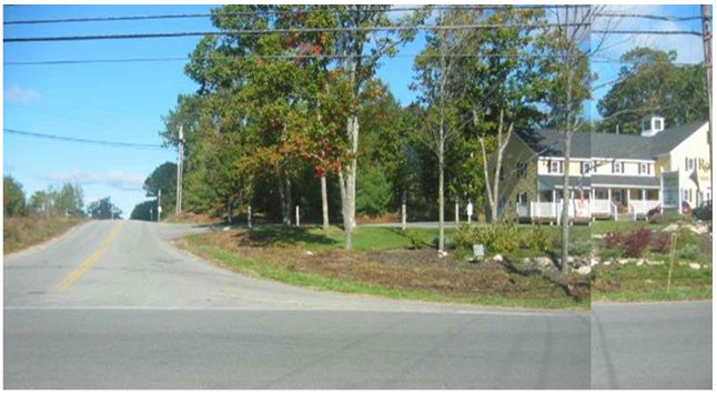
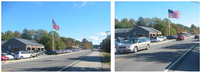
III. Gateway 1 Corridor, Maine
Why Gateway 1 Corridor?
The Gateway 1 Corridor is an area that shows success in gaining support and cooperation from all 21 existing towns along the corridor. They have shown achievement in implementing access management practices and strategies among the 21 towns while carefully preserving the local culture of each town.
A. Access Management Program
The access management program for Maine includes access management rules, corridor planning, and preservation initiatives. The program focus is on prioritized planning and the preservation of mobility arterial corridors that are most at risk of losing capacity, safety, and of decreasing posted speeds, due to increasing development and commuter/visitor pressures.
The corridor planning and preservation program includes corridors where MaineDOT, in partnership with adjoining municipalities, property owners, corridor committees, scenic byway corridor committees, and other stakeholders along a mobility arterial join forces to develop strategies that assure the stated purposes of the Access Management Law are met and maintained. Corridor planning and preservation program partnerships would outline appropriate locations for access management techniques. The following lists some of the salient features of the Gateway 1 Corridor initiative.
- It was undertaken to get the 21 towns along the Gateway 1 Corridor in mid-coast Maine to work together to implement access management practices where applicable.
- The initiative is intended to address many dimensions, including access management. Route 1 serves multiple purposes because there is no parallel interstate highway route. As a result, there is a need to balance the needs of local traffic and through traffic.
- Local agencies regulate access on state highways in Urban Compact Areas on roadways with posted speeds of 35 miles per hour or less. MaineDOT regulates access on other state highways. There are examples in Damariscotta and Newcastle where MaineDOT purchased access rights along sections of the Route 1 corridor.
- MaineDOT purchases access rights along the corridor whenever possible so they can implement access management practices before the land is developed for future use.
- MaineDOT manages access from the perspective of land use as well as transportation.
- MaineDOT places a strong emphasis on preserving high speeds outside urban compact areas. However, they manage speed limits throughout the corridor to maintain safety and movement of traffic.
- The program has minimized or severely limited traffic signals along the corridor where appropriate and safe.
- "Double frontage" developments (those with access to more than one street) provide greater access management opportunities by allowing MaineDOT to limit access to the lower-function roadway. See pictures on page 18.
- Maine has put a large focus on public participation and public education of access management so the public understands and is aware of the importance of access management.
- The access management program is implementing driveway regulations and has been eliminating those driveways with safety issues, traffic hazards, or limited sight distance.
What Is It Enabled By?
The following lists several enabling factors to the success of access management along the Gateway 1 Corridor, Maine.
- The 119th Maine Legislature approved LD 2550, An Act to Ensure Cost Effective and Safe Highways in Maine. The full set of rules became effective on May 25, 2002.
- The purpose of the act is to assure the safety of the traveling public and protect highways against negative impacts of unmanaged drainage. The law is intended to ensure safety, manage highway capacity, conserve state highway investment, enhance economic productivity related to transportation; and conserve air, water, and land resources.
- The act specifically directs MaineDOT and authorized municipalities to promulgate rules to assure safety and proper drainage on all state and state aid highways with a focus on maintaining posted speeds on arterial highways outside urban compact areas.
- The law also requires that the rules include standards for avoidance, minimization, and mitigation of safety hazards along the portions of rural arterials where the 1999 statewide average for driveway related crash rates is exceeded. Those rural arterials are referred to in the rules as "Retrograde Arterials.
- On Mobility Arterials, a second access would not be allowed, if it would not meet spacing requirements and if it is requested for a subdivision that was created after the effective date of the rules (May 25, 2002) specifying the spacing. Where there would be insufficient sight distance at a driveway, no waivers are allowed. Insufficient sight distance is the main reason for denial of access.
- While there is no explicit law to aide inter-local agreements for shared revenue projects, Access Management Law: Title 23 Section 703 is the first step.
- Title 23 Section 703 states that if the municipal officers of one or more municipalities determine it necessary that a public road be constructed to spur economic development, downtown revitalization or neighborhood preservation; to create new housing stock; to promote mixed-use or densely settled village centers; or to enhance public safety, then the municipal officers may petition the Department of Transportation to finance from the Highway Fund up to 50% of the cost of the proposed road construction, subject to available funds.
- First Park is Maine's first inter-local industrial and business park in which the participating communities invested and shared revenues on a prorated basis according to the level of investment. (See link under "Important Links.")
- MaineDOT issues "traffic movement permits" which are part of a process used to help implement access management.
- MaineDOT can deny access on non-conforming lots, even if there is no alternative access.
- The access management program focuses on coordination and planning between multiple jurisdictions along the corridor to better achieve the successful implementation of access management practices.
- 30-A MSRA 4103 D-An entrance permit is required from MaineDOT prior to the issuance of a building permit by the municipality.
- 30-A MSRA 4404 (5)-Entrance approval documentation is required prior to Subdivision approval by the Planning Board (onto State roads in non-compact areas)
- In those places where MaineDOT owns the right of way, towns cannot get access to put in curbs on the public roads.
- Municipalities control all roads that have speed limits less than 35 mph.
What Is Unique To The Gateway 1 Corridor?
- All 21 towns along the Gateway 1 Corridor signed a Memorandum of Understanding, in which they agree to work together to develop a long-range plan for access management. Inter-local agreements are being put into place to help guide future actions in the corridor. A sample of the memorandum of understanding is provided in Appendix C.
- The Gateway 1 Corridor project is successfully addressing a previously disjointed situation by encouraging neighboring towns to talk to each other.
B. Outcomes
Planning for and implementing access management practices along the Gateway 1 Corridor has successfully aided in moving traffic while maintaining a level of aesthetics acceptable to the affected town.
- There have been different outcomes for towns that controlled access by buying access rights along that corridor. This is demonstrated in the following two examples:
- Damariscotta has a bypass and bought the access rights along it, so the bypass road is fully access controlled. This gave the downtown a greater opportunity to redevelop the area, which yielded positive results for local business.
- Waldsboro has a bypass but does not control access along it. The resulting highway commercial development along the bypass did nothing to benefit the downtown.
- MaineDOT is using a new "Eco-Logical" approach that has positive impacts along the corridor. The main objective is to look at the environment, transportation, and land use as one whole system rather than isolated elements.
- The program has successfully improved and helped maintain relationships between multiple jurisdictions along the corridor. This was an area of difficulty in the past.
- MaineDOT suggested towns select an area that needs improvement and affects both towns and share revenues to implement access management practices in that area.
- The access management program helps establish a future plan and set of guidelines and regulations to guide future driveway permit actions.
- While building a bypass to every town would cost nearly $1 billion, MaineDOT works on building frontage and backage roads. This has proven to be a better investment that helps transportation, local business, aesthetics, tourist traffic, and safety. See pictures on page 18.
- One ongoing problem is the common disregard for the impact of land use decisions on the adjoining towns. MaineDOT is continuing to work with these towns to have them better understand that cooperation in implementing access management practices can yield greater results than working independently.
C. Gateway 1 Examples:
- Rollins Furniture and Interior Design is located in the northwest quadrant of the intersection of Sheepscot Road and Route 1. MaineDOT requires that access to Rollins Furniture and Interior Design be from Sheepscot Road and not from Route 1. MaineDOT has the authority to limit access to "double-frontage lots" (i.e. corner properties with frontage two roadways) to the lower-function roadways. The pictures on the next page show the Rollins Furniture example as well as a second example demonstrating the need for alternative driveways along the corridor.
- Remy's Plaza is located in the northwest quadrant of the intersection of Route 1 and Route 3. A median was installed to prevent left-turn egress from a Remy's Plaza driveway on Route 3 that is near the intersection with Route 1. Some additional travel is needed for drivers must turn left to access Route 1 via a signalized driveway on Route 3 that is further west of Route 1. Relocating the left-turn egress movement has improved traffic operations and safety.
- There is an example of an un-signalized jug handle on Route 1 in Belfast to accommodate the southbound left-turn movement.
Picture: Gateway 1 Corridor, Maine
Shows an example of alternative access-a site, Rollins Furniture, that is accessed by a side road rather than directly to Route 1.
Picture: Gateway 1 Corridor, Maine
Shows the need for alternative access-this local business has five driveway entrances up along the highway.
D. Lessons Learned
1. Successes
The major key to success with the implementation of access management along the Gateway 1 Corridor is due to the cooperation gained from the 21 towns. Following are several keys to success in Maine:
- MaineDOT worked to make sure a consistent access management program was set up, is being carried out across multiple political jurisdictions, and is showing continued signs of success.
- Cooperation along the corridor was accomplished through the creation and signing of the Memorandum of Understanding. Each town signed a Memorandum of Understanding stating their agreement to work together to develop a long-range plan for access management. MaineDOT is also writing inter-local agreements to be signed by all 21 towns to help guide future decisions in access management.
- The program has succeeded in coordinating and planning for access management between multiple jurisdictions. One key tool to this success was the Memorandum of Understanding, explained above.
2. Challenges
The following list contains some of the challenges encountered in Maine:
- One ongoing problem is the common disregard for the impact of land use decisions on the adjoining towns. MaineDOT is continuing to work with these towns to have them better understand that cooperation in implementing access management practices can yield greater results than working independently.
- With continued success in access management, towns along the Gateway 1 Corridor realize that relationships are a critical component in maintaining current and promoting future access management programs.
3. If We Had It To Do Over Again...
The following list includes what MaineDOT would change if they were able to redevelop the access management program from the beginning for the Gateway 1 Corridor.
- MaineDOT would place more focus on synchronizing land use with transportation before development occurs.
4. Risks Going Forward
The following are risks that MaineDOT has identified in going forward with access management.
- One risk could be the reticence of local jurisdictions to use their land use planning authority to enable access management.
5. Other Background
- The Gateway 1 Corridor has five regional planning agencies and the following neighboring towns:
- Region 1: Brunswick, West Bath, Bath, and Woolwich.
- Region 2: Wiscasset, Edgecomb, Newcastle, Damariscotta, and Nobleboro.
- Region 3: Waldoboro, Warren, Thomaston, and Rockland.
- Region 4: Rockport, Camden, Lincolnville, and Northport.
- Region 5: Belfast, Searsport, Stockton Springs, and Prospect.
6. Team Conclusions
The following are conclusions made by our team about the access management program along the Gateway 1 Corridor, Maine.
- Access management implementation efforts have shown signs of success along a corridor where town aesthetics, history, and culture must be maintained.
- Maintaining relationships between towns is critical to the future success in implementation of access management.
7. Important Links
- MaineDOT's Access Management website can be accessed at the following site: http://www.maine.gov/mdot/planning-process-programs/access-mngmnt.php
- MaineDOT's Highway Driveway and Entrance Rules can be accessed via: ftp://ftp.state.me.us/pub/sos/cec/rcn/apa/17/229/229c299.doc
- Information on Maine's first inter-local industrial business park, First Park, can be found at the following site: http://www.firstpark.com/content/4000/Home/
- Access Management Law: Title 23 Section 703 can be found at the following site: http://janus.state.me.us/legis/statutes/23/title23sec703-B.html